
From raw data to ready decisions
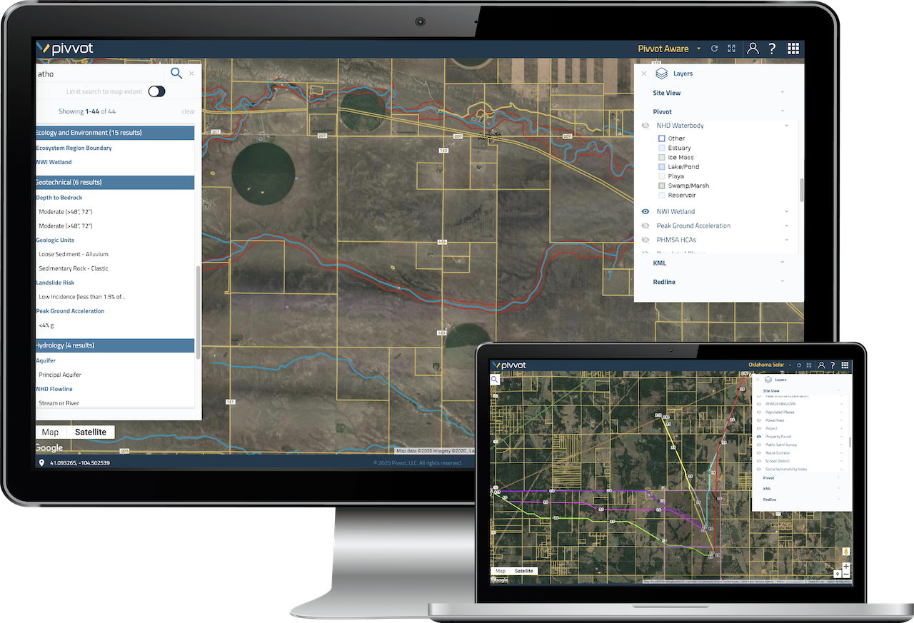
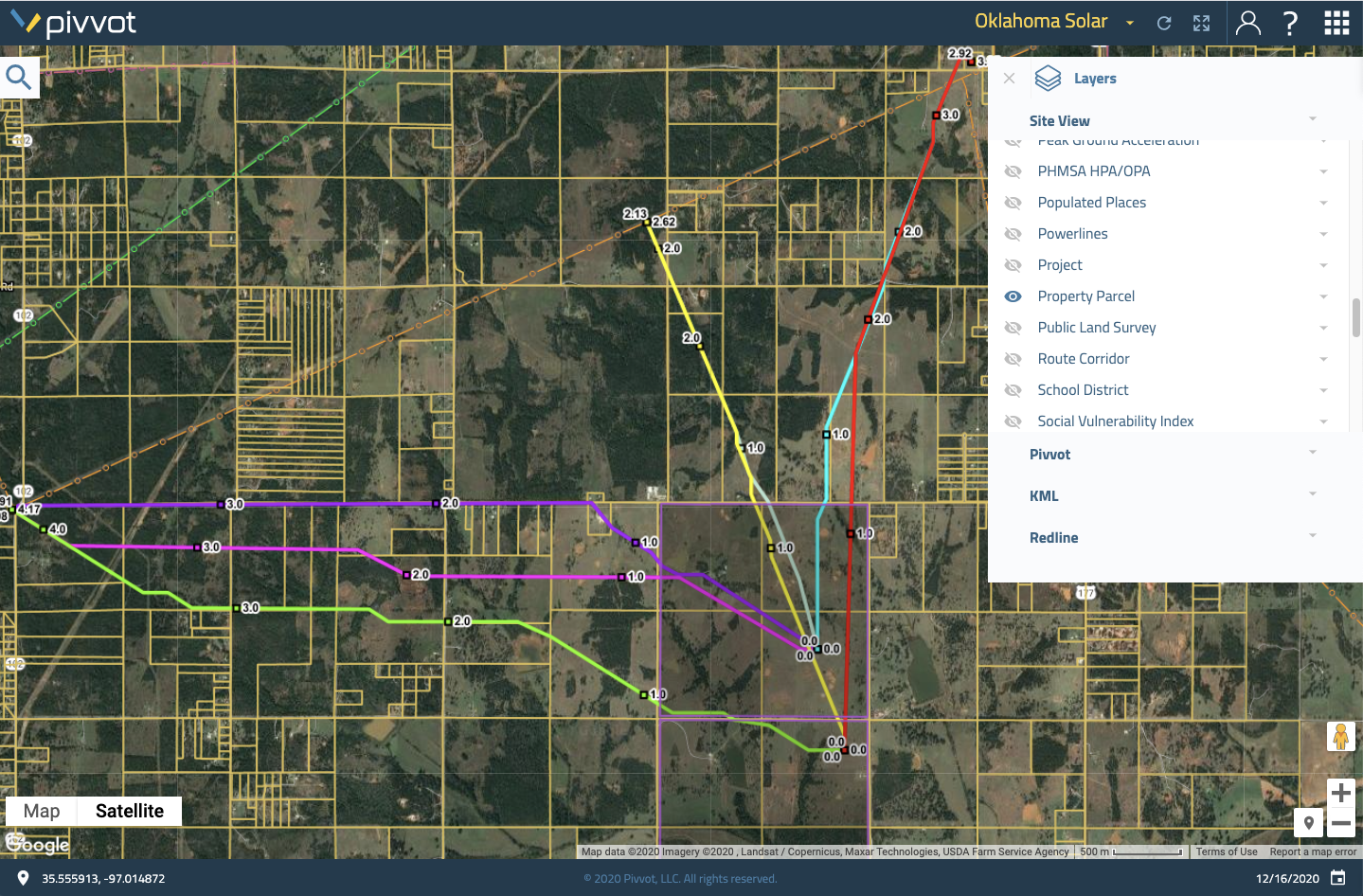
The Pivvot platform transforms project planning with real-world data and geospatial tools for siting, routing, permitting, and field verification. Teams use Pivvot to cut planning time, reduce permitting risk, and deliver defensible decisions faster.
Pivvot platform features
Data visualization
- Upload your assets or third-party data to visualize any area of interest
- Leverage your subject matter expertise to extend Pivvot’s data and refine your reports
- Toggle data layers on and off to view key constraints across any U.S. location
- Download Pivvot data for your area of interest and use it to enhance your preferred reporting systems
- Collaborate easily with your team, clients, and partners on a fast, intuitive, map-based interface
Analysis solutions
- Siting analysis: Accelerate renewable energy site selection and reduce delays in go-to-market timelines
- Project analysis: Drop a point, draw a route or polygon, and instantly understand environmental and permitting risks
- Routing analysis: Routing Analysis: Generate optimized, constraint-aware routes using your project criteria and Pivvot’s data
Reports and analytics
- Crossing and impact report: identify crossings and evaluate critical impacts for any linear corridor
- Permit report: understand jurisdictional boundaries and generate a list of permitting requirements
- Parcel report: instantly produce parcel reports with ownership, zoning, and other critical attributes
- Cost surface report: visualize project suitability and cost implications across multiple site options

Get Pivvot subscription
- Instantly access endangered species, parcels, and wetlands data
- View social vulnerability and political boundaries
- Upload, draw or generate sites and assets

Deliver defendable design
- Provide crossing and impact reports to regulatory, environmental, and engineering teams
- Avoid permitting issues and environmental constraints
- Model multiple sites and scenarios to demonstrate due diligence

Improve project planning
- Improve building materials lists and cost estimation
- Identify permits earlier in the project lifecycle
- Evaluate site alternatives to avoid environmental and landowner issues

Accelerate schedules and save money
- Save months of manual data collection and analysis
- Generate preferred routes and conduct site analysis in hours
- Reduce time in field and permitting delays

Safety and security
Keep your data safe with private cloud space, explicit firewalls, SSL encryption and stringent authentication controls.

Affordable and scalable
Reduce IT support, eliminate hardware, and allow your storage/usage to grow as needed using our cloud-based location intelligence software.

Reliable and protected
Enjoy peace of mind with 99.9% uptime, regular vulnerability and security tests, and redundant failover strategies.
Cloud-based collaboration
From the field to the boardroom, project stakeholders use Pivvot to:
- Understand what’s surrounding an asset or a proposed site
- Evaluate suitability and permitting requirements
- Capture field collected data to support project studies
- Identify areas of greatest risk or concern
Watch this video to learn how we securely deliver parcel, environmental and engineering data to teams across an enterprise to support collaboration.
Helping energy and infrastructure teams move projects faster, smarter, and with confidence
Pivvot provides location data and analytic solutions to streamline siting, routing, and permitting to support our nation’s transition to renewable energy. Request a demo to understand how we can support workflows for:
- Renewable Developers
- Power Utilities
- Natural Gas Utilities
- Engineering and Construction Firms
- Environmental Services