Streamline Siting, Suitability & Permitting to Reduce Project Costs
Identifying and evaluating sites is an expensive and time consuming process which can take weeks or even months. Pivvot has all the data collected, prepared and ready to use on a single map.
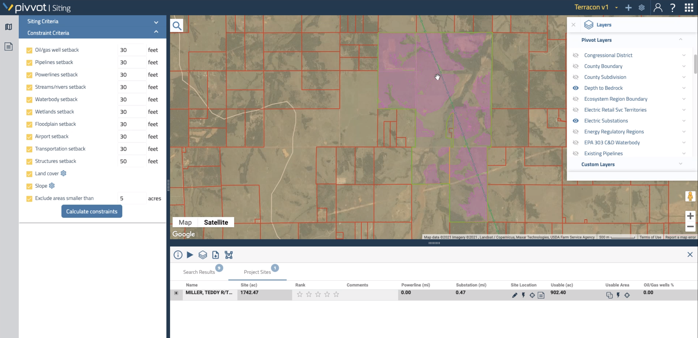
Pivvot allows you to access critical data on protected areas, critical habitat boundaries, land owner conflicts, waterways and political boundaries.
Pivvot compiles hundreds of datasets and quickly displays them on a user friendly map from any device, anywhere without the need for specialist interpretation.
Data & Analytics to Understand the Area Surrounding Your Project
Immediately generate detailed parcel reports whether you’re developing a multi-state transmission corridor, a multi-state pipeline route or for development of a new solar site.
Pivvot’s reports provide insight into subsurface conditions, parcel characteristics, slope suitability, endangered and protected species, land cover and land ownership records.
Expedite the permitting process by analyzing jurisdictional boundaries surrounding your project to generate a list of required permits.
Speed up renewable energy development projects and get to construction faster. Pivvot provides data for site suitability studies, environmental impact assessments and permitting to help you choose the right parcel of land for renewable energy development.
Pivvot’s engineering and construction software enables firms to produce more competitive FEL, FEED, permitting and environmental estimates to be able to respond to RFPs more quickly and win more profitable projects.
Pivvot provides the environmental, jurisdiction, soil and land use data to quickly evaluate and identify the best route for pipelines, whether that’s connecting gathering sites to a mainline, or routing a new mainline across a region.
Pivvot’s environmental impact assessments provide defendable crossing points and impact analysis to help environmental firms gain a better understanding of risk factors, natural barriers and protected areas surrounding development sites.
The team generated multiple routes and was able to select the least-cost minimal impact option. With Pivvot, they’ve seen over 50% savings on project schedule time.
With Pivvot, they moved the project to a nearby, suitable location that reduced the number of permits required and helped avoid environmental impact risk.
Pivvot was able to locate, prepare and deliver the data in less than two weeks, shaving time off the project and ensuring a swift delivery to the client.