Know what could derail your site or route before you commit.

Wetlands. Protected species. Setbacks. Floodplains. Easements. Slope. Land ownership.

Pivvot brings critical land, environmental, infrastructure, and jurisdictional data together so you can identify constraints, compare alternatives, and focus on sites and routes with a stronger foundation for development.

Rare species. Real risk.

A promising location can look very different once environmental, land, and permitting constraints are considered. Pivvot helps reveal potential issues early, before your team invests heavily in fieldwork, acquisition, engineering, or permitting.


Give us a sample location and let us show you how Pivvot can help.

Could any of these affect your project?

  • Protected species and sensitive habitat
  • Wetlands, waterways, and floodplains
  • Protected lands and land-use restrictions
  • Parcel boundaries and ownership conflicts
  • Easements, setbacks, and access limitations
  • Terrain, slope, soils, and subsurface conditions
  • Jurisdictional and permitting requirements
  • Existing infrastructure and crossings

Pivvot’s data offering includes environmental and ecological information such as critical habitat and land cover, hydrology data such as wetlands and aquifers, land-management information, infrastructure, terrain, parcel, ownership, and jurisdictional data.

Designing with avoidance in mind.

Finding a site or drawing a route is only the beginning. The real question is whether that location can support your project requirements.

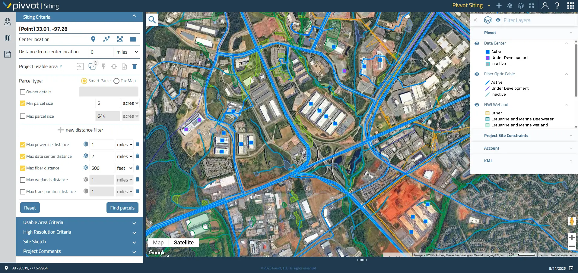
Pivvot helps developers, utilities, engineers, GIS teams, and planners evaluate potential locations using hundreds of geospatial datasets in one cloud-based platform. See environmental risks, land characteristics, infrastructure, ownership, and regulatory considerations together, rather than researching each factor through disconnected sources.

With Pivvot, your team can:

  • Screen potential sites and corridors
  • Identify environmental red flags
  • Calculate usable acreage
  • Compare multiple alternatives
  • Evaluate parcel and ownership considerations
  • Understand crossings and potential impacts
  • Generate reports for project discussions
  • Prioritize where additional due diligence is warranted

Pivvot provides access to more than 500 geospatial datasets and supports routing, site selection, land due diligence, and environmental review. 

Go from Location Data to Project Direction

One Platform for Complex Location Decisions.
Take a look.