AI-ready, powerful geospatial data for your GIS platform — accelerate your projects and proposals with Pivvot spatial data intelligence

Standardized, quality-assured location intelligence datasets delivered at scale — advancing routing, siting, environmental, and land workflows within your existing platforms.

Pivvot Location Data

Spatial analytics that give your team and organization location-driven intelligence to make crucial project and business decisions

Pivvot data solutions is secure, ready-to-use, rigorously curated spatial data used by GIS professionals, data scientists, engineers, planners, energy developers, utilities, real estate teams, construction firms, environmental specialists, and Architectural / Engineering / Construction firms. Organizations that rely on geospatial data intelligence to accelerate analysis, improve operational clarity, and support strategic decision making make smarter decisions with Pivvot data solutions.

Every dataset is validated, standardized, and refreshed using automated update schedules.

icon drawing a route from one place to another

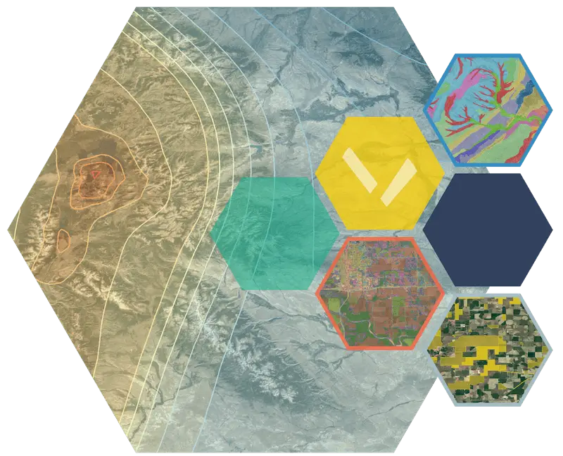
Pivvot data solutions — 500+ actively refreshed, ready-to-use datasets for the mainland United States

We’ve done all the hard work. Pivvot data solutions is cleaned, structured, and optimized for enterprise GIS performance. Make confident business and project decisions backed by consistent, accurate, uptodate spatial data.

Access a comprehensive library of standardized datasets, including:

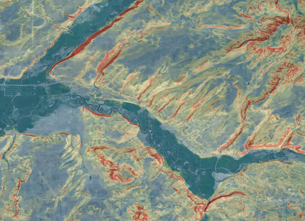
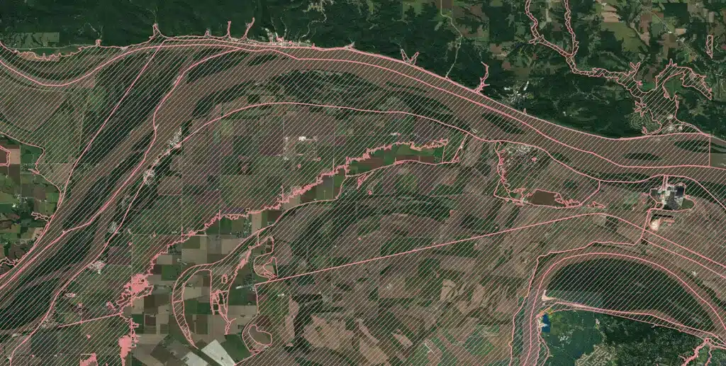
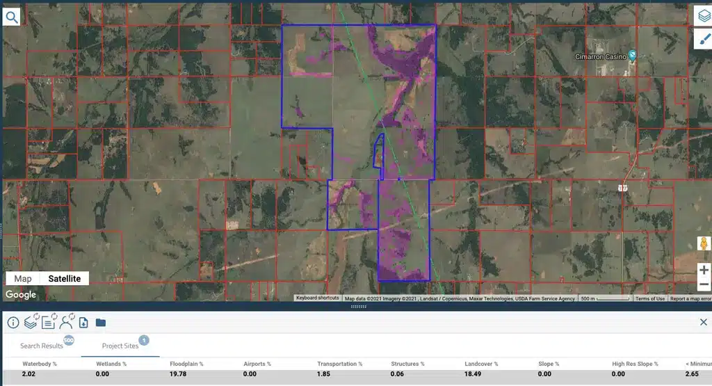
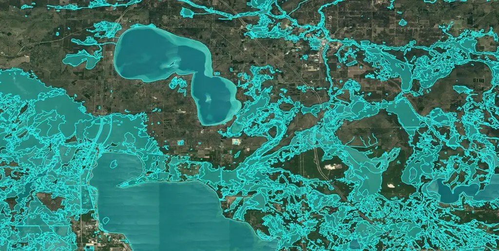
  • Environmental and Geotechnical Constraints
    Wetlands, protected areas, flood zones, species, and soils
  • Energy and Infrastructure
    Pipelines, transmission lines, substations, ROWs
  • Land and Ownership
    Smart Parcels, land use, tax maps, easements
  • Regulatory and Risk Layers
    PHMSA, EPA, state-level datasets
  • Base Mapping Layers
    Elevation, terrain, imagery, hydrology, transportation

With a subscription to Pivvot data, you can subscribe to individual datasets or the entirety of the Pivvot database.

Pivvot Data Consultants

What types of organizations use Pivvot data solutions?

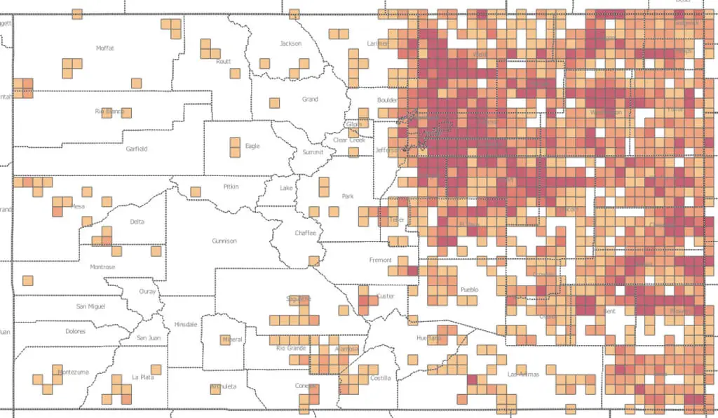
Large companies, GIS teams, engineering and environmental firms, renewable energy companies, major utilities and grid providers, and oil and gas exploration and development groups that need geospatial data to perform high-volume spatial analysis for activities such as site selection consideration, linear route evaluation, environmental impact assessments, and permit planning.

Pivvot data is ideal for businesses performing:

  • Pipeline and utility network planning
  • Renewable energy projects such as solar, wind, hydroelectric, and electric battery
  • Enterprise-wide data standardization
  • Permitting and environmental compliance
  • Large-scale asset risk analysis

Our Data is the Difference

Empower your organization with
Pivvot data solutions

Consistent, current, and defensible data that strengthens decisions, accelerates workflows, and supports mission-critical operations at scale

Pivvot data supports the needs of your teams:

GIS Teams

  • Unified data source for spatial analytics, one source of spatial truth
  • Reduced time spent normalizing datasets and manually processing data
  • Confidence in data lifecycle, with an annual subscription, you have the most recent data available

IT and Firm Leaders

  • Scalable licensing, only the datasets you need or the entire Pivvot database
  • Ease of integration – Pivvot data in your familiar system or enterprise platform 
  • Secure cloud delivery – access to Pivvot data in hours, not weeks.

Engineering and Development Teams

  • Supports pipeline routing, site selection, and design workflows
  • Unified data source for spatial analytics, one source of spatial truth, across all your U.S. offices
  • Familiar Google Earth UI, so limited or no ramp-up time to use Pivvot

Environmental and Land Departments

  • Reliable data for environmental impact assessments and permitting
  • Crossing & Impact data for your route projects or opportunities
  • Smart Parcels to best evaluate available or potential land parcels

Pivvot data solutions — delivered to your GIS, BI, or enterprise system how you need it.

Custom Location Data Integration
  • API access for spatial analytics and modeling
Pivvot Platform Download
  • Streaming data services (WMS/WFS/tiles)
  • Bulk data delivery to cloud storage
yellow data storage icon with circular arrows
  • Custom refresh cycles for enterprise workflows
Data-Quality
  • Standardized schemas for environmental, land, and infrastructure analysis

Learn more

Boundary Data

Understand political and social vulnerability risks to your project. 

  • Congressional District
  • Electric Retail Service Territories
  • Energy Regulatory Region
  • Natural Gas Service Territories
  • Oil & Gas Production Area
  • Organizational Boundary
  • PHMSA Populated Places
  • Public Land Survey
  • Public Safety Answering Point
  • School Districts
  • State Legislative Districts
  • Municipal Boundaries
  • LiDAR Availability (USGS)

Geotechnical Data

Support construction planning, inform cost estimates and lower operational risk. 

  • Elevation
  • Fault Area
  • Fault Lines (w/ Active)
  • Geological Unit
  • gSSURGO Corrosivity Concrete
  • gSSURGO Corrosivity Steel
  • gSSURGO Depth to Bedrock
  • gSSURGO Depth To Water
  • gSSURGO Flood Frequency
  • gSSURGO Frost Susceptibility
  • gSSURGO Hydric Soils (Potential Wetland Soil Landscape)
  • gSSURGO Hydrologic Group
  • gSSURGO Loess/Eolian Deposits
  • gSSURGO pH
  • gSSURGO Prime Farmland
  • gSSURGO Shrink-Swell Potential
  • gSSURGO Soils
  • Karst Topography (Terracon)
  • Landslide Risk
  • Peak Ground Acceleration
  • Percent Slope

Hydrology Data

Inform permitting requirements and project planning.

  • Aquifer
  • Commercially Navigable Waterway
  • EPA Protected Waterbody
  • 100-Year Flood Plain
  • 500-Year Flood Plain
  • Levee
  • NHD Flowline
  • NHD Waterbody
  • NWI Wetlands
  • Watershed
  • Wild & Scenic Rivers
  • USGS Stream Gauges

Land Use & Property Ownership Data

Understand zoning, support land acquisition planning, and prepare cost estimates.

  • Cultural Resources State Level (Above ground, state coverage TX, AL, AR)
  • Land Cover
  • Land Ownership Conflicts
    • Agricultural
    • Commercial/Industrial
    • Conservation/Environmental
    • Cultural/Heritage
    • Education/Research
    • Energy/Resource Extraction
    • Government
    • Hazard/Remediation/Waste
    • Low Mobility/Gathering Place
    • Military
    • Native American
    • Recreation
    • Residential
  • National Register Historic Places
  • Property Parcel

Energy & Infrastructure Data

Examine colocation opportunities, understand material needs, and develop permitting punch lists.

  • Cemeteries
  • Communication Towers & Obstacles
  • Contaminated Sites
  • Data Centers
  • Electric Transmission Powerline
  • Electric Transmission Substations
  • EPA Greenbook
  • Existing Pipeline
  • Federal Registered Sites
  • Fiber Optic Cables
  • Fifty Foot Structure Buffer
  • Greenhouse Gas Emitters
  • Interconnect Queue
  • Points of Interest
  • Railroads
  • Roads
  • Trails
  • Wind Turbines

Jurisdiction Data

Understand Federal, State and County permitting to avoid scheduling delays.

  • County Boundary
  • Dept. of Transportation Districts
  • Municipal Boundary
  • State Boundary
  • U.S. ACE Districts
  • U.S. BIA Regions
  • U.S. BLM Admin. Units
  • U.S. BOR Regions
  • U.S. DOI Regions
  • U.S. EPA Regions
  • U.S. FEMA Regions
  • U.S. Federal Lands
  • U.S. FWS Regions
  • U.S . FS Regions
  • U.S. NMFS Regions
  • U.S. NRCS Regions
  • U.S. Tribal Lands

Community & Society Data

Evaluate social vulnerability and identify opportunity zones.

  • Environmental Justice
  • Social Vulnerability

Ecology & Environment Data

Reduce ecological and environmental impact and evaluate permitting needs earlier in process.

  • Critical Species Habitat
  • Ecosystem Region Boundary
  • State Level Species (TX, CA, FL)
  • Species Range

Weather Data

Understand historical weather events to evaluate insurance costs.

  • Hail Events
  • Lightning Strikes
  • Tornado Events
  • Wind Events

Get started

See how Pivvot can accelerate your next project