
Turn location data into action — faster
One subscription, unlimited users, and unmatched spatial analytics—one geospatial data platform that your entire team can collaborate on, evaluate project viability, uncover risks, and generate defensible impact reports in minutes.

Spend less time finding data and more time delivering results with Pivvot
What Can You Do with a Pivvot platform subscription?
A Pivvot platform subscription gives your team instant access to powerful spatial analytics software, 500+ actively refreshed datasets, and purpose‑built tools that streamline every stage of routing, siting, land research, and environmental review.
Whether you’re planning a pipeline, developing renewable energy sites, acquiring land, or evaluating wetlands or species risks, Pivvot helps you move faster with more confidence when you use Aware, Siting, or Route.


Which industries benefit most from a Pivvot platform subscription?
Any team that needs reliable spatial analytics, pipeline routing software, site suitability software, or environmental impact assessment software to provide location data information and analysis for a client, internal team, or for their own business.
Industries with proven success using Pivvot:
- Power utilities
- Oil and gas
- Renewables (solar, wind, hydroelectric)
- Transportation and railroad
- Infrastructure development
- Telecommunications
- Engineering and construction
- Economic development
- Commercial real estate development
Ready to learn which Pivvot subscription is right for your team?

“Pivvot’s technology and its comprehensive approach to big data analytics reduces our design time and enhances project delivery, allowing us to provide transformational value and quality to our customers.”
– Vice President Pipeline Engineering
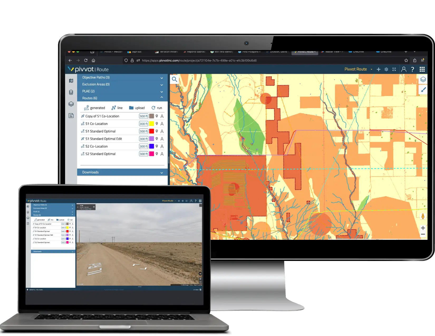
Analyze and visualize geospatial data instantly
Turn complex geospatial questions into clear, actionable answers fast. With the Pivvot platform, your team can:
- Perform spatial overlays, buffers, proximity analysis, and constraints mapping in seconds
- View all data layers—environmental, land, utility, regulatory, hazards—in one unified platform
- Generate interactive maps that can be shared across teams and contractors
- Eliminate desktop software installs using powerful in-browser tools in a familiar UI
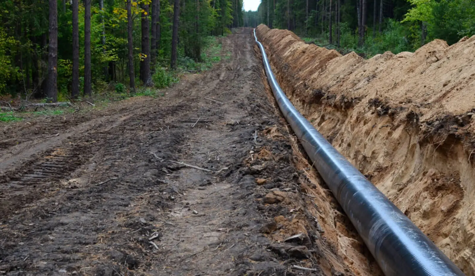
Rapid routing and pipeline corridor analysis
Perform rapid routing and corridor analysis with tools purpose-built for pipeline workflows. With the Pivvot platform, your team can:
- Compare multiple route alternatives in minutes
- Evaluate constructability, environmental constraints, land ownership, and cost drivers
- Build cost surfaces to guide least cost path decisions
- Identify potential permitting risks early
- Export routes to GIS, CAD, or engineering design software
Ideal for oil, gas, LNG pipeline development, transportation corridor expansion and development, and electric grid and transmission distribution expansion.
Clean Energy companies and Engineering firms use Pivvot
“Pivvot allows me to view route or site and run detailed crossing reports in a matter of minutes — without help from a data analyst or GIS person.”
– Project Director, Engineering & Construction Firm
Accelerate land research and due diligence
With the Pivvot platform, your team can move faster with land research and due diligence with enriched parcel intelligence and Smart Parcels, Pivvot’s exclusive advantage for land acquisition teams. With the Pivvot platform, your team can:
- Instantly view parcel boundaries, ownership, APNs, tax data, and assessed values
- Access Smart Parcels with deeper attribution, standardization, and continuous updates
- Identify encumbrances, easements, setbacks, access constraints, and nearby hazards
- Layer parcels with environmental and infrastructure data to evaluate risk quickly
- Create contact lists, summaries, and due diligence‑ packets in minutes
- Prioritize parcels using suitability scoring and custom criteria
Smart Parcels – example shows parcels 200 acres or greater owned by the same entity
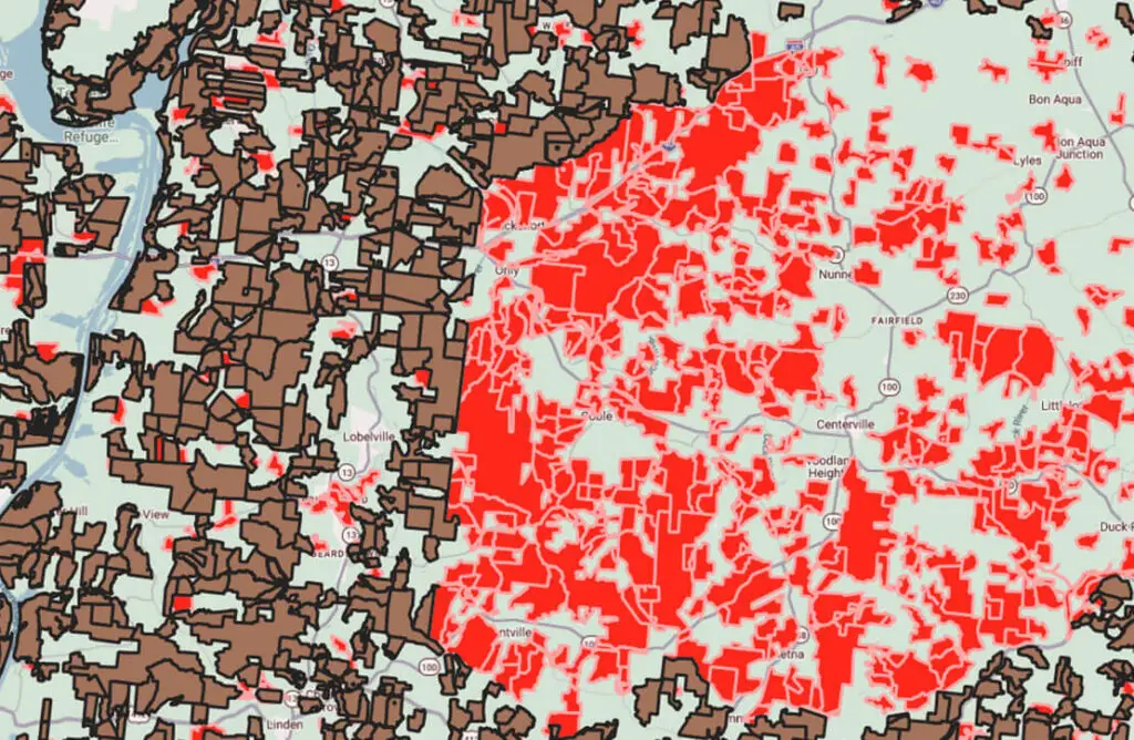
KEY
Brown = Tax map parcels 200 acres or greater
Red = Smart Parcels (merged tax map parcels owned by the same entity that combined are 200 acres or greater)
Green = areas are less than 200 acres
Identify the best sites with suitability scoring
Accelerate development using configurable site suitability software tools.
- Score land parcels or locations based on custom criteria
- Incorporate environmental, regulatory, infrastructure, and proximity factors
- Quickly identify buildability, interconnect proximity, and setback compliance
- Compare sites across counties, regions, or entire states using constraints and usable areas
- Apply weighted scoring to reflect stakeholder priorities
Ideal for solar, wind, hydrogen, industrial development, battery storage, and utility siting.
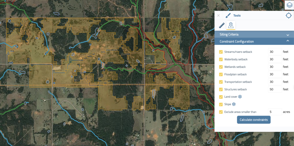
Conduct environmental and regulatory reviews
Conduct environmental and regulatory reviews with standardized, defensible, and up-to-date spatial data. The Pivvot platform allows you and your team to:
- Map environmental constraints such as wetlands, floodplains, species, soils, and protected areas
- Reduce permitting surprises by identifying sensitive or restricted areas
- Produce defensible environmental review reports and permitting lists
- Standardize data used across contractors and internal teams
Constraints Analysis Sample Report

Perform risk assessments and encroachment monitoring
Perform risk assessments and encroachment monitoring to understand risk across your assets, planned routes, or proposed sites. With Pivvot you can:
- Overlay hazards, regulated areas, population densities, and environmental constraints
- Identify encroachments near transmission lines, pipelines, or utility corridors
- Support internal risk, integrity, and safety teams with standardized data
- Enable proactive mitigation rather than reactive problem solving
Use Case: Lower Risks with Lightning Data

Client: Integrity Services Firm
Industry: Oil & Gas Pipeline Transmission
Problem Statement: Acquire lightning strike data to inform risk management
On a recent risk management project, an Integrity Management Firm needed to calculate the likelihood of a lightning strike on a segment of pipe. The client wanted to acquire historical lightning data in the area. The Pivvot data services team researched multiple data sources and delivered the highest quality information for the project.
The Pivvot team was able to locate, prepare, and deliver the data in less than two weeks, shaving time off the project and ensuring a swift delivery to the end-client.
Standardize data and workflows across your teams
With a Pivvot platform subscription, you can give every contractor, stakeholder, and internal group access to the same source of truth to:
- Use consistent datasets, schemas, and refresh cycles across projects
- Ensure decisions are defensible with versioned, documented analysis
- Reduce rework caused by outdated or mismatched data
- Empower GIS, engineering, land, environmental, and PM teams with shared tools
- Improve collaboration across distributed offices or partner organizations
Ready to get a subscription?
Export, share, and integrate with your GIS and engineering systems
Pivvot enables you to export, share, and integrate location data with your GIS and engineering systems without disrupting existing workflows. Easily plug Pivvot into your existing workflows, and your team can:
- Export as KML, KMZ or File Geodatabase (.gdb).
- Generate reports, maps, spreadsheets, and analysis artifacts
- Share projects internally or with external partners
- Maintain clean, standardized geometry and metadata
- Supports all major spatial analytics workflows
“We’ve partnered with Pivvot to provide continuously up-to-date data in a cloud-based platform to our experts, allowing them to focus on more technical work.”
– Melissa Miller, GIS Manager at Spec Services
Get started
See how Pivvot can accelerate your next project.