Turn location intelligence into key business decisions
Find the right location. Understand the risk and plan your path forward.
Every project starts with questions about location. Where can we build? What could delay development? Which route creates the least impact? What data do our teams need to make the decision?
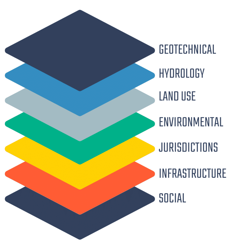
Pivvot brings land, parcel, environmental, infrastructure, jurisdictional, community, and physical-setting data together so teams can answer those questions earlier in the project lifecycle.
One source of location intelligence. More ways to put It to work.
Pivvot brings location intelligence into the earliest stages of siting and routing, helping your team compare alternatives and uncover potential constraints before committing significant resources. Across pipelines, electric transmission, renewable energy, and digital infrastructure, the Pivvot software platform and spatial data help narrow the field sooner and focus further investigation on the strongest options.
Pivvot Platform
Bring every location decision into one platform
Give your team a shared environment for visualizing spatial data, evaluating project conditions, and collaborating across siting, routing, permitting, and environmental workflows.
The Pivvot Platform combines geospatial data with practical analysis and reporting tools. Explore hundreds of location datasets, compare alternatives, and generate parcel, permitting, crossing, impact, and cost-surface reports from an intuitive map-based interface.
Key features:
- Cloud-based spatial analytics and data visualization
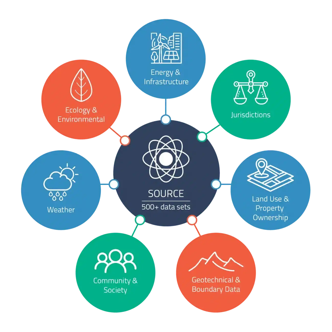
- 500+ curated location datasets
- Data uploads and configurable map layers
- Parcel, permit, impact, crossing, and cost-surface reports
- Collaboration across teams, clients, and project partners
Aware
Understand what surrounds and affects a proposed project location without beginning with extensive fieldwork or searching across disconnected data sources.
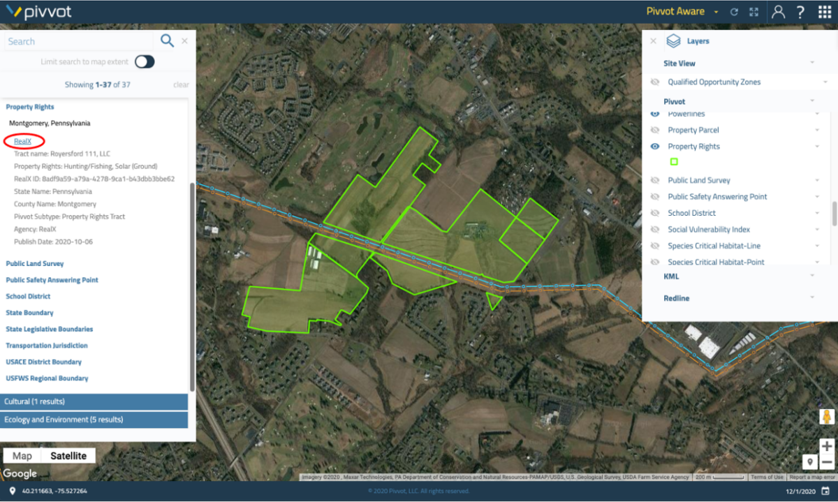
Aware brings land, environmental, social, parcel, and jurisdictional information into one map. Upload or sketch a project area, examine potential constraints, compare locations, and generate customizable crossing, impact, and permitting reports in minutes.
Key features:
- Project-area analysis using points, lines, or polygons
- Environmental, parcel, land, and community context
- Side-by-side project-site comparisons
- Crossing and impact reports
- Federal permitting checklists and jurisdictional review
Route
Develop defensible routes in less time
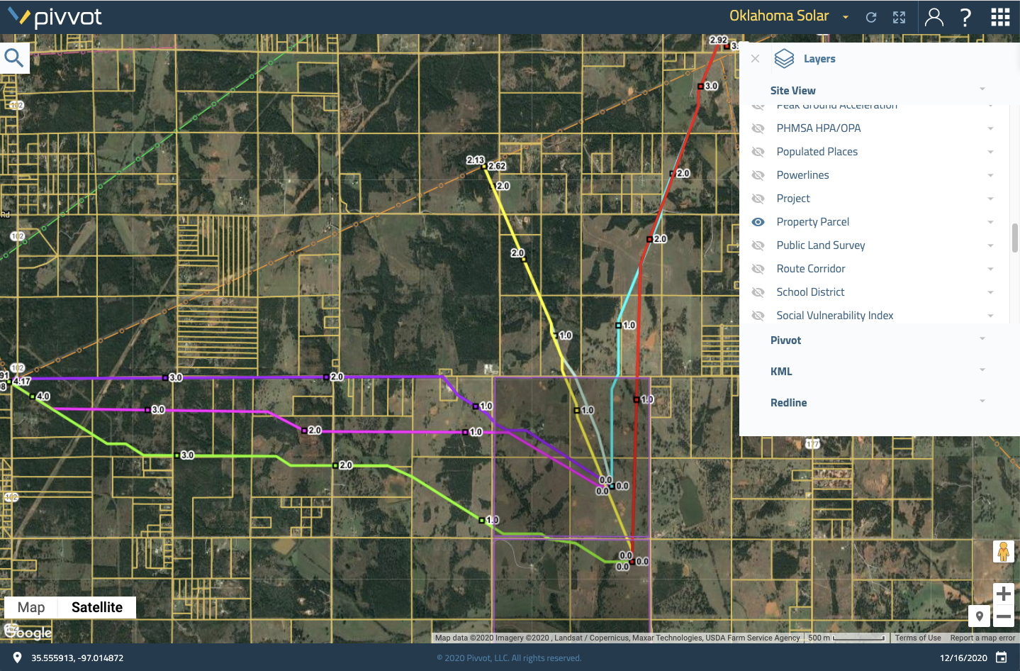
Generate, evaluate, and compare routes using the project criteria and constraints that matter to your organization.
Route helps pipeline, electric transmission, fiber, and other linear infrastructure teams model preferred routes while considering environmental impacts, land ownership, engineering conditions, jurisdictions, permitting issues, and protected areas. Teams can generate constraint-aware alternatives and detailed crossing and impact reports before extensive fieldwork begins.
Key features:
- Point-to-point route generation
- Preferred, low-avoidance, avoidance, and exclusion criteria
- Cost-surface and constraint visualization
- Side-by-side route comparisons
- Crossing, impact, and permitting reports
Siting
Identify viable sites sooner
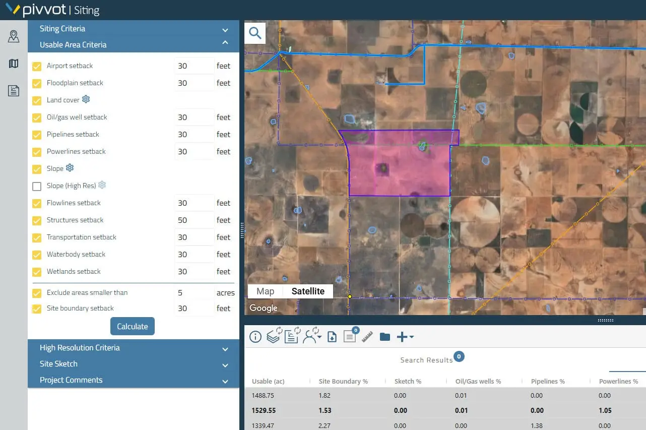
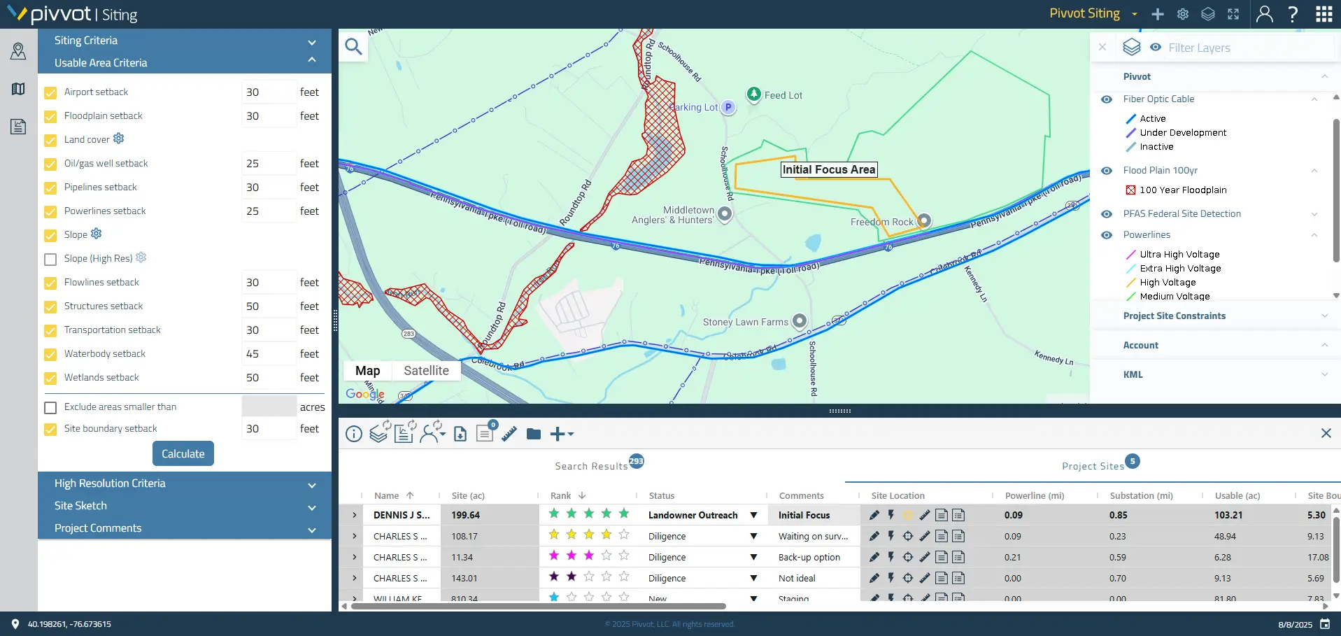
Quickly screen locations, calculate usable acreage, and focus development resources on sites with stronger potential.
Siting helps teams evaluate parcel ownership, infrastructure access, topography, wetlands, floodplains, soils, species habitat, and other development considerations. Apply project criteria, visualize constraints, compare candidate sites, and export data for due diligence, outreach, engineering, and design.

Key features:
- Large-area site screening and suitability analysis
- Usable-acreage calculations
- Smart Parcels – enhanced parcel and land-ownership
- Environmental, infrastructure, terrain, and geotechnical data
- Site comparisons and exportable data packages
Source
Location data can be your business advantage
Give your teams ready-to-use location intelligence without building and maintaining the data infrastructure behind it. Source reduces repetitive data preparation while providing a consistent foundation that can support analytics, planning, operations, risk, strategy, and other business needs. Source makes curated datasets available for use in the systems that fit your current systems. Don’t change the way you work, just make it easier. As priorities evolve, your organization can expand the data it uses without rebuilding the foundation each time.
Reporting and analytics
Find project risks before they cause delays
Reveal the environmental, permitting, land, and infrastructure conditions that can influence project feasibility. Pivvot reporting and analytics helps teams evaluate potential impacts earlier, compare alternatives consistently, and support recommendations with traceable location data.
Key features:
- Permitting matrix
- Crossing and impact analysis for sites and linear corridors
- Parcel, ownership, and jurisdictional reporting
- Configurable reports using project-specific data
- Shareable findings that support due diligence
Pivvot is a wholly owned subsidiary of Terracon